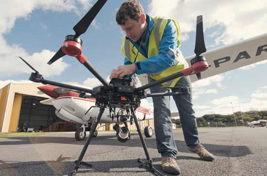
U-Flyte is a strategic research partnership, coordinated by Maynooth University and funded by Science Foundation Ireland, together with key industry collaborators including Airbus, Irelandia Aviation and INTEL. The project was launched in March 2018 in Waterford Airport by Maynooth University, SFI and industry partners.
This SFI partnership will tackle the current global bottleneck impeding the wider development of drone operations and roll-out of commercial services. The R&D work-plan is based around researching a series of inter-connected work-packages that deal with investigating, building and testing Unmanned Aircraft Systems (UAS) Traffic-Management (UTM), underpinned by a 3D drone airspace model (U-Space).
U-Flyte have announced 4 new Phd opportunites , see table below for more details;
| PhD Project | Project Description | How to apply |
| 3D Pathfinding & traffic management architectures for large-scale urban drone operations | Funded by Science Foundation Ireland and involving collaboration with Industry partners including Airbus, Irelandia Aviation and Intel, U-Flyte is a R&D partnership, established to tackle the current global logjam impeding the wider development of drone operation and rollout of commercial services. The research work-plan is based around a series of inter-connected work-packages that deal with the development of novel airspace modelling tools and drone traffic management systems – also known as U-Space and Unmanned Traffic Management (UTM) systems. Advanced flight-testing is carried out at Waterford Airport and selected mobile locations across Ireland. Drone services including mapping, monitoring and logistics. Specialist aerial support services will also be developed and tested using real-world, end-use case scenarios. U-Flyte comprises Geospatial Scientists, Software Engineers, Mathematicians, Domain Specialists and Drone Operations personnel, working with the latest Vertical Take-off and Landing (VTOL) and hybrid drones, sensors (Optical, LiDAR, Navigation, Radar) and cloud computing resources. At the heart of U-Flyte is advanced computational expertise including autonomous navigation, Machine Learning and Geospatial Analytics all dedicated to developing the next generation of Beyond Visual Line of Sight (BVLOS) autonomous drone services.
U-Flyte now wishes to recruit PhD candidates to join this aerial robotics team based within the National Centre for Geocomputation (NCG), an established research centre at Maynooth University. We would especially like to hear from candidates with good primary degrees in Computing or Mathematics interested in developing careers in Aerial Robotics, Machine Learning, Computer Vision & Geospatial Data Analytics. If you feel you have the right background and want to know more – please get in touch. This project focuses on the creation of new U-Space models & UTM systems designed to handle large numbers of autonomous drones carrying out a variety of data gathering, logistic and robotic activities in urban environments. This PhD will explore various algorithms and models that are required for constructing these new airspaces and enabling optimal traffic routing and overall management. |
Please contact Dr. Lucy Cradden, U-Flyte Project Manager at [email protected] to discuss further. |
| Developing automated risk analysis and modelling tools for drone operations | Funded by Science Foundation Ireland and involving collaboration with Industry partners including Airbus, Irelandia Aviation and Intel, U-Flyte is a R&D partnership, established to tackle the current global logjam impeding the wider development of drone operation and rollout of commercial services. The research work-plan is based around a series of inter-connected work-packages that deal with the development of novel airspace modelling tools and drone traffic management systems – also known as U-Space and Unmanned Traffic Management (UTM) systems. Advanced flight-testing is carried out at Waterford Airport and selected mobile locations across Ireland. Drone services including mapping, monitoring and logistics. Specialist aerial support services will also be developed and tested using real-world, end-use case scenarios. U-Flyte comprises Geospatial Scientists, Software Engineers, Mathematicians, Domain Specialists and Drone Operations personnel, working with the latest Vertical Take-off and Landing (VTOL) and hybrid drones, sensors (Optical, LiDAR, Navigation, Radar) and cloud computing resources. At the heart of U-Flyte is advanced computational expertise including autonomous navigation, Machine Learning and Geospatial Analytics all dedicated to developing the next generation of Beyond Visual Line of Sight (BVLOS) autonomous drone services.
U-Flyte now wishes to recruit PhD candidates to join this aerial robotics team based within the National Centre for Geocomputation (NCG), an established research centre at Maynooth University. We would especially like to hear from candidates with good primary degrees in Computing or Mathematics interested in developing careers in Aerial Robotics, Machine Learning, Computer Vision & Geospatial Data Analytics. If you feel you have the right background and want to know more – please get in touch. Drone operation will always result in risk to varying degrees and both static and dynamic sources of risk need to be measured, classified and ultimately understood. Static risk includes vulnerable zones such as school yards, car-parks and exposed recreational parks. Dynamic risk includes weather and indeed other drones in flight. This PhD will deal with developing new methodologies and computational models to record, analyse and model risk as a fundamental input to U-Space/UTM system design. |
Please contact Dr. Lucy Cradden, U-Flyte Project Manager at [email protected] to discuss further. |
| Adaptable Machine Learning techniques for dynamic aerial scene understanding | Funded by Science Foundation Ireland and involving collaboration with Industry partners including Airbus, Irelandia Aviation and Intel, U-Flyte is a R&D partnership, established to tackle the current global logjam impeding the wider development of drone operation and rollout of commercial services. The research work-plan is based around a series of inter-connected work-packages that deal with the development of novel airspace modelling tools and drone traffic management systems – also known as U-Space and Unmanned Traffic Management (UTM) systems. Advanced flight-testing is carried out at Waterford Airport and selected mobile locations across Ireland. Drone services including mapping, monitoring and logistics. Specialist aerial support services will also be developed and tested using real-world, end-use case scenarios. U-Flyte comprises Geospatial Scientists, Software Engineers, Mathematicians, Domain Specialists and Drone Operations personnel, working with the latest Vertical Take-off and Landing (VTOL) and hybrid drones, sensors (Optical, LiDAR, Navigation, Radar) and cloud computing resources. At the heart of U-Flyte is advanced computational expertise including autonomous navigation, Machine Learning and Geospatial Analytics all dedicated to developing the next generation of Beyond Visual Line of Sight (BVLOS) autonomous drone services.
U-Flyte now wishes to recruit PhD candidates to join this aerial robotics team based within the National Centre for Geocomputation (NCG), an established research centre at Maynooth University. We would especially like to hear from candidates with good primary degrees in Computing or Mathematics interested in developing careers in Aerial Robotics, Machine Learning, Computer Vision & Geospatial Data Analytics. If you feel you have the right background and want to know more – please get in touch. Drones are capable of flying for more than an hour, covering tens of kilometres in distance, recording GigaBytes of combined optical and navigation data. Automated classification and measurement of man-made and natural features will become an increasingly important role for data-gathering drones. This PhD will investigate novel Machine learning (ML) tools and methodologies for identifying objects and activities in real-world scenes. These new ML tools will be tested and assessed for a variety of mapping, monitoring, defect inspection and anomaly detection tasks |
Please contact Dr. Lucy Cradden, U-Flyte Project Manager at [email protected] to discuss further. |
| Sensor fusion for innovative Aerial and Ground based Detect and Avoid (DAA) systems | Funded by Science Foundation Ireland and involving collaboration with Industry partners including Airbus, Irelandia Aviation and Intel, U-Flyte is a R&D partnership, established to tackle the current global logjam impeding the wider development of drone operation and rollout of commercial services. The research work-plan is based around a series of inter-connected work-packages that deal with the development of novel airspace modelling tools and drone traffic management systems – also known as U-Space and Unmanned Traffic Management (UTM) systems. Advanced flight-testing is carried out at Waterford Airport and selected mobile locations across Ireland. Drone services including mapping, monitoring and logistics. Specialist aerial support services will also be developed and tested using real-world, end-use case scenarios. U-Flyte comprises Geospatial Scientists, Software Engineers, Mathematicians, Domain Specialists and Drone Operations personnel, working with the latest Vertical Take-off and Landing (VTOL) and hybrid drones, sensors (Optical, LiDAR, Navigation, Radar) and cloud computing resources. At the heart of U-Flyte is advanced computational expertise including autonomous navigation, Machine Learning and Geospatial Analytics all dedicated to developing the next generation of Beyond Visual Line of Sight (BVLOS) autonomous drone services.
U-Flyte now wishes to recruit PhD candidates to join this aerial robotics team based within the National Centre for Geocomputation (NCG), an established research centre at Maynooth University. We would especially like to hear from candidates with good primary degrees in Computing or Mathematics interested in developing careers in Aerial Robotics, Machine Learning, Computer Vision & Geospatial Data Analytics. If you feel you have the right background and want to know more – please get in touch. At the heart of this PhD will be the principle that drones can only fly safely, |
Please contact Dr. Lucy Cradden, U-Flyte Project Manager at [email protected] to discuss further. |